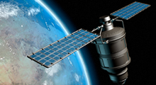


SAKURA – GSR research pattern are Image Processing and Modelling, which are tailored exclusively for digital image processing and modelling of high-resolution digital airborne and Satellite data. Algorithm Development-Digital Image Processing, Data Fusion, Several levels of automated and manual processing are available Robust and innovative approaches.

SAR team at SAKURA-GSR works on the development of interpretation keys for various targets in SAR images, development of innovative research ideas for forest, agriculture and urban areas mapping. Research in ship detection, and monitoring is one of the most important applications based on SAR data, both for safety and security purposes.

Our software team supports many internal research initiatives and service work carried out for our clients. These range from 3D Textured City Modelling of DSM to 3D Tree Modelling implemented in VB and VC++. It involves semi-automatic, and automatic 3D building/object reconstruction modelling from airborne and satellite based data.

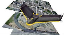
Low cost service by operating Unmanned Aerial Vehicles for Mapping Projects in inaccessible areas.
SAKURA-GSR along with its UAV DRONE collaborator would undertake study SAKURA-GSR would bring in its Remote Sensing, GIS, Photogrammetry and Software IT application experts to complete the study.


