Algorithm Development-Digital Image Processing, Data Fusion, Several levels of automated and manual processing are available Robust and innovative approaches.
For the purposes of image processing and modelling of high-resolution airborne digital images, SAKURA-GSR utilizes special low-level image-processing library.
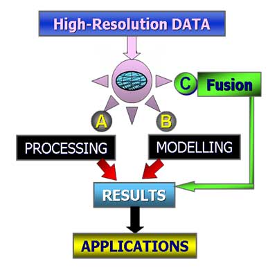
SAKURA –GSR research ideas are two pronged:–
Processor and Modeller, tailored exclusively for processing and modelling of high-resolution remote sensing data
1. Processor
Image processing and enhancement by using low-level vision tools
2. Modeller
Modelling of data for 3D
IMAGE SHARPENER
PATTERN RECOGNITION IN SHADOW REGIONS
MAGE PROCESSING & 3D MODELLING SOFTWARE
- SAKURA-GSR often introduces new image processing, modelling and vision tool for high-resolution airborne digital images.
- Our research team performs image processing and modelling of high-resolution remote sensing data by using novel computer vision methods.
- We make combination of tools for image functions, image processing, modelling, mapping and viewing.
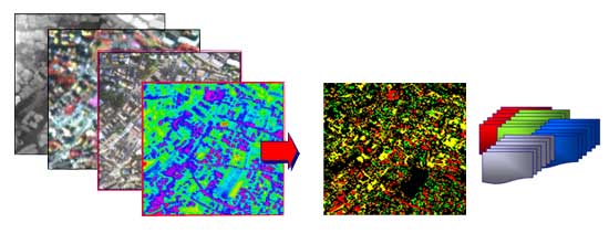
DISPARATE DATA FUSION
A High-Level fusion method to fuse disparate High-Resolution Airborne sensor data for change-detection application.


