SOFTWARE DEVELOPMENT EXPERTISE
SAKURA-GSR capabilities are mainly in Research and Software Development with multi-disciplinary team of technical experts. These draw on the strong academic links that SAKURA-GSR has with the Softopia Japan, Keio University-Japan, Indian Institute of Technology-located at Mumbai and Chennai, led by PhD level experts.
Our Software team supports the many internal research initiatives and service work carried out for our clients. These range from 3D City modeling of DSM, 3D tree modeling, Data Management, to the digital airphoto processing, SAR data processing for defense and navy applications, LIDAR data application for avalanche studies and disparate applications.
New Research Ideas and algorithms are generally tested and prototyped using stand-alone programs. Many new ideas have been implemented in VB and VC++.
SAKURA-GSR is investigating various methods of mapping and modelling from airborne and satellite based data.
SAKURA-GSR also expertise in Photogrammetry, LiDAR and GIS covering the verticals and horizontals such as Environment and Forestry, Agriculture , Geology and Mining, Land Use Mapping, Web Based Mapping, cadastral mapping, Road Inventory system development etc.
WE HAVE EXPERTISE IN
- GIS and Remote Sensing
- C++, VB,JAVA,J2EE and ARCGIS
- Databases: MS SQL SERVER,ORACLE,MYSQL
- Analytical Mathematics
- Image Processing
- Satellite Remote Sensing
- Cadastral Mapping Expertise
SERVICES
- Engineering Data Services
- Geomatics Solutions
- Bathymetry
- Airsurvey-support
- Software Consultancy
- Training in R.S & GIS
- Software Marketing
Our services also include Project Design and management, Flight planning and GCP surveys, Scanning, Aerial triangulation and Block adjustment, Planimetric mapping, Digital elevation and terrain modeling (DEM/DTM), Map editing and Digital orthophotography. SAKURA-GSR, in addition, offers a wide range of LiDAR data processing services.
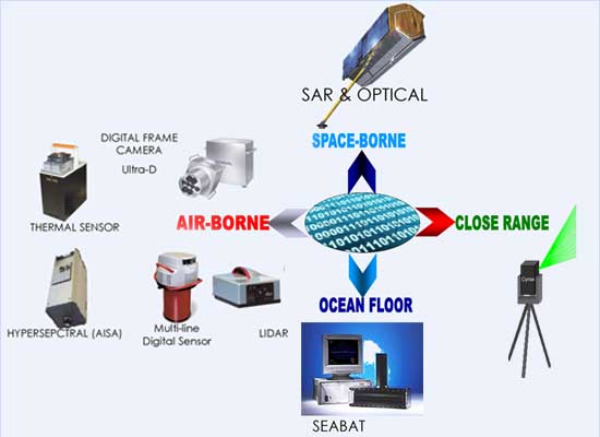
AIR-BORNE TO SPACE-BORNE DATA RESEARCH AND APPLICATIONS
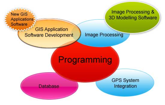
SOFTWARE DEVELOPMENT EXPERTISE
Our software team supports many internal research initiatives and service work carried out for our clients.
New research ideas and algorithms Many new ideas have been implemented in VB and VC++.
Research ranges from 3D City modelling of DSM, 3D tree modelling, Data Management, to the digital airphoto processing, SAR data processing for defense and navy applications, LIDAR data application for avalanche studies and other disparate applications. SAKURA-GSR is investigating various methods of mapping and modelling from airborne and satellite based data.
SAKURA-GSR also has expertise in Photogrammetry, LIDAR and GIS covering the verticals and horizontals such as Environment and Forestry, Agriculture , Geology and Mining, Land Use Mapping, Web Based Mapping, cadastral mapping, Road Inventory system development etc.


