Wireless Field Monitoring Server and sensors network
Background
eDAMs consists of Field Sensors, data cards, communication systems, data processor and software. The Agent System is designed on the assumption that every component can be accessed through the network. With such a system, it is possible to monitor disparate parameters related to water and dam environment dynamically. In our wide-ranging system, the sensors communicate to a client server at high speed, and acquire other relevant data such as air temperature, humidity, PPFD (Photosynthesis Photon Flux Density), UV, CO2 concentration, soil-moisture, canopy transpiration (EC), leaf-wetness, wind speed/direction and GPS for several applications.
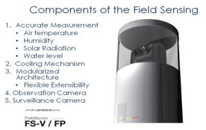
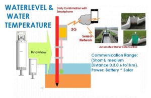
At present, we will provide only required sensors such as Water Level viewer, Temperature, Humidity and Rainfall depends on the availability for this POC study. The project will exploit a multifunctional outdoor server, Field Server (FS), which is compact, rugged and economical. FS is water-proof, dust-proof and heat-resistant system. The collected data would be valuable for Policy Makers.
The importance of DAM monitoring and conservation has been a hot topic in governments all over the world. In Reservoir monitoring related projects, it is essential that various types of information should be provided in real time in order to prevent the occurrence of damages to structures and related events. The specific required information differs for outflow and inflow, and it is therefore necessary to change the measurement program as necessary for each situation. Additionally, data processing for extracting useful information from a vast quantity of available or newly collected data is highly desirable. Thus, a long-term monitoring system should be able to cope with these subjects, reduce the amount of effort required of the user and acquire useful supporting information.
The common requirement for monitoring is the need to monitor under harsh environmental conditions in many places over long periods of time. Because of the hostile weather and geographical conditions in catchment areas, mostly reserve-forest in Tamilnadu, it is difficult to perform monitoring of remote dam sites where there are no infrastructures for providing power or networking capabilities. Again periodical maintenance and data collection are difficult to carry out at remote installation sites which often experience severe weather conditions, and the users must not only devote considerable time to monitoring, but also have access to various technologies and specialized knowledge.
The key need for eDAMs is information which will allow forecasting WHERE, WHEN and HOW water condition in reservoirs. This will be achieved by collecting and analysing on the data obtained from Field Sensors and servers. Apart from water-level information, other information sets (environmental) such as rainfall, air temperature, vegetation status and soil moisture will be obtainable.
Thus, in the present case of Dam monitoring,
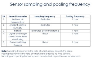
- Efficient hourly/daily data collection required.
- What is desired is a flexible, adaptable monitoring system that can utilize various type of information, change the measurement program as necessary for each developmental stage, and control and operate peripheral equipment in a remote site.
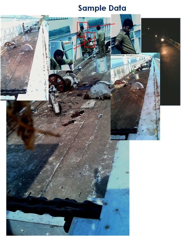
- In addition, the system can treat large blocks of data such as images that help determine Dam, Water and surroundings conditions.
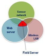
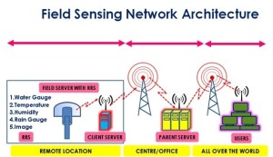
- In order to meet such needs, we propose a long-term remote field monitoring system consisting of a sensor network equipped with a Web server for measurement and wireless LAN for data transmission.
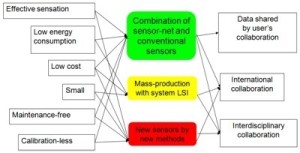
- Traditional sensor networks use exclusive radio communication and must minimize the amount of data and communication time to save power.
- The wireless LAN of our proposed system provides a high-speed transmission network and long-distance communication for large image files at a low price.
The broad objectives are:
- To develop a FS based data collecting Sensors to congregate Dam sight data.
- To analyse the database observed from the sensors at pilot study areas.
- To develop a WebGIS server for eDAMs data collection, processing and monitoring.
- Preparation of daily or monthly reports to policy makers.
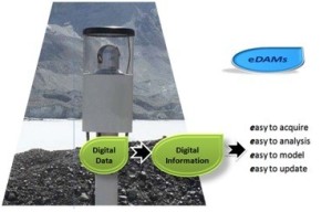
The methodology of the present proposal is three pronged (Fig.1).
- Development of Field Server-GPS-GIS system to monitor Dams in selected sites.
- Processing of data in real-time through a WebGIS server.
- Modelling the database.
Benefits
- This project promotes a new concept of monitoring reservoir automatically.
- Certainly FS based data collection will replace the conventional methods practised now. This project will reduce conventional method of collecting data.
- By adapting this technology, will help Tamilnadu government’s engineers to become leaders in advanced analytical stream.
- Extensive and exhaustive computational experiments will be made to produce a high quality, efficient and easy to use solver package for engineers, statistician, and group of other scientists.
- This can be viewed as one of the scientific/technological needs that Tamilnadu Government currently wants.
- The outcome of this project will enhance future development and execution of advanced allied technology and research that will be led by PWD.
- This project will also greatly extend the strategic goals of the PWD for reservoir monitoring and controlling automatically from a centralised server at the Head Quarters.
- It will help train highly well educated workforce who can sustain and improve the department infrastructure as well as economic growth.
- This project will produce Engineers who will become experts in planning and managing reservoirs.
